




Tutte le aste / Altro / United Kingdom - Sussex, England; William Schmollinger - Sussex - 1821-1850

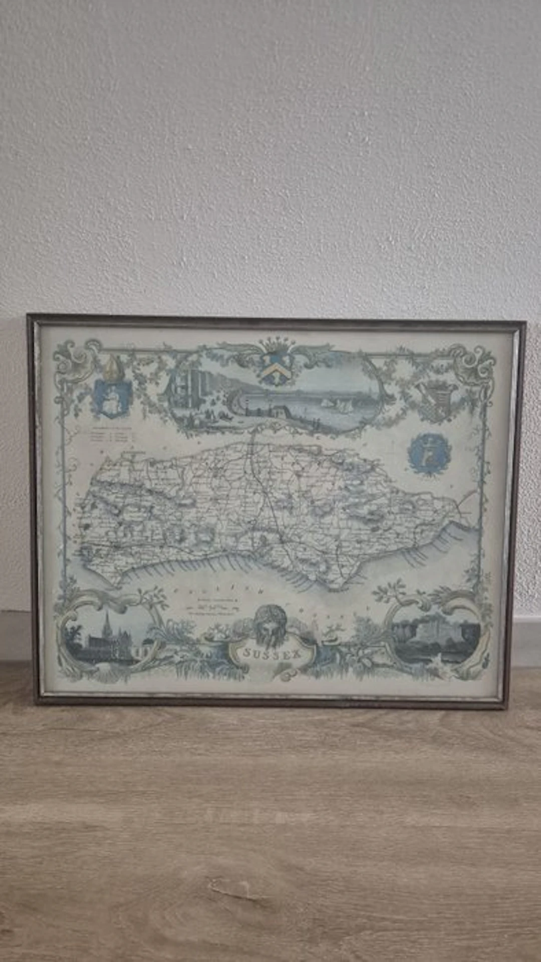
This is the well-known historical map of the English county of Sussex, originally designed by the famous English cartographer Thomas Moule and engraved by William Schmollinger. This particular map was first published around 1836–1840 in Moule's well-known atlas “The English Counties Delineated”. Moule was renowned for his highly decorated, neo-Gothic style. The map contains several characteristic historical elements: • Top illustration (Vignette): A detailed view of the Brighton Chain Pier. • Left and right vignettes: Illustrations of Chichester Cathedral (lower left) and Arundel Castle (lower right). • Decorative elements: Various family crests (coats of arms) of local nobility and an ornate cartouche at the bottom with the name "SUSSEX". Map of Sussex from 1825 by W. Schmollinger, published by Wrightsons Foil Graphics. The map is perfect for lovers of topographic history and local sights. Dimensions of the map without frame: 50.5 cm x 40 cm.
Stima:€180
Vai all’astaStima:
€180




Porta la tua asta ai collezionisti di tutto il mondo!
Pubblica oraIscrivendoti, accetti la politica sulla privacy. Annulla l'iscrizione in qualsiasi momento.
Barnebys HQ
Brahegatan 10
BOX 5038
114 37 Stockholm
