Henry S. Tanner Lithographed Map of the United States of Mexico, 1846
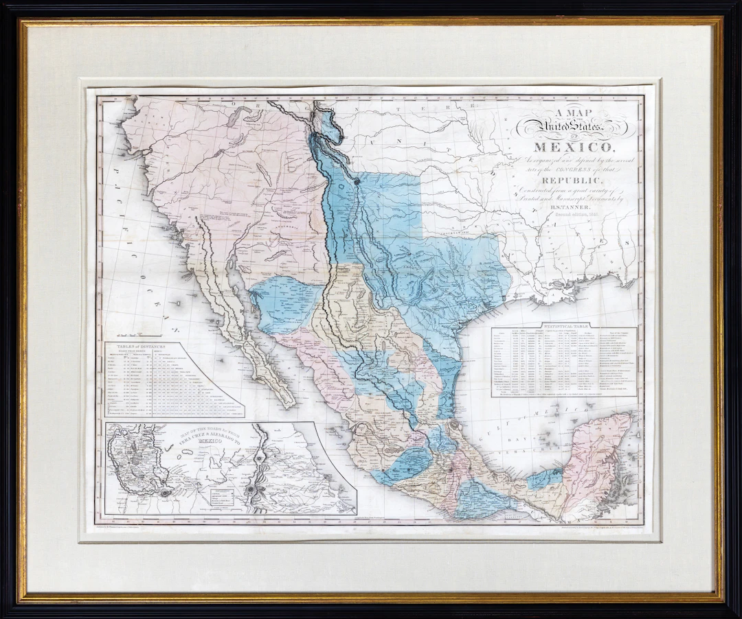
TANNER, Henry S. (1786-1858). A Map of the United States of Mexico, as Organized and defined by the several acts of Congress of that Republic. Lithograph with original hand color. New York: H.S. Tanner, 1846. 23 1/2" x 29 3/4" sheet, 32 1/2" x 39" framed. Tanner's map of Mexico, based on the works of Humboldt, Pike, Darby, and others, were primary sources for cartographic intelligence on Mexico and the emerging western territories of the United States. The first Tanner map to contain the Fremont information. Issued in 10 variants of one or another of five states of the map up to 1847. The present map is officially termed the "1846, second edition," although it is actually the seventh variant of the map to be issued, according to Ristow's classification. It closely follows the "1832, second edition," even including the "April 2nd, 1832" copyright imprint in the lower right corner. At this time, interest in all matters relating to Mexico and Texas amongst the American public was at an all- time high, and it is thought that Tanner hastily prepared this edition in order to capitalize on the commercial opportunities. Tanner did not take the time to avail himself of the most recent geographical advances, and consequently this map is a fascinating cartographic hold-out during a time of unprecedented change. Texas is portrayed as an enormous Mexican state, although it had since 1832 seceded, and later joined the Union as an American state. Its massive territory extends far to the north and west of its modern limits, following the eastern band of the Rio Grande up to its headwaters, up into the "stovepipe" to a point touching the 42nd parallel. The geographical detailing of most of Texas is quite accurate, as Tanner was well apprised of Stephen F. Austin's surveys, a point underscored by his inclusion of "Austin's Colony" in east-central Texas. In an improvement to its antecedent, the western portion of the state owes its form to William Emory's map of 1844.
Stima:€21,081.62
Vai all’astaVedi tutti gli oggetti diArader GalleriesoLibri, Mappe & Manoscritti