





Tutte le aste / Libri, Mappe & Manoscritti / France - Le Pays de Caux: present-day Normandy

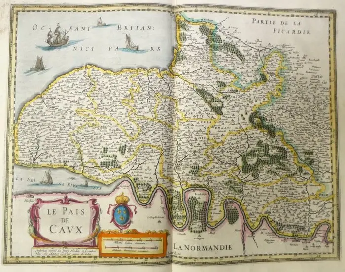
Old copper-engraved map of the Pays de Caux (Normandy) hand-enhanced by Hondius, published in 1633 in the Mercator-Hondius atlas. It shows the Pays de Caux from the coast of the Manche to Rouen and the Vexin. The main towns, including Dieppe, Fécamp, Harfleur, Caudebec, Aumale, Neufchâtel and Gisors, are depicted in vignettes. Villages are represented by small houses, and the forests, notably those of Lyons and Eu, by groves colored in green. To the north, the ocean is animated by a pennant-festooned ship and three craft. The Seine estuary bears two sailing vessels and a rowboat. The title cartouche with scrollwork, the crowned fleur-de-lis arms, and the scale cartouche occupy the bottom of the map. French text on the reverse (p. 253, 'Le Baillage de Caux'), with historiated initial. The imprint reads: 'à Amsterdam imprimé chez Henry Hondius, et se vendent à Paris chez Melchior Tavernier auprès du Palais'. - Dimensions: on sheet: 56 x 47.5 cm; on the plate (map proper): 46.9 x 35.3 cm - Condition: Good overall for a map of this period. Presence of a central vertical crease, brown stains in the upper left margin, and light soiling. See photos for details. Atlas Mercator-Hondius - The atlas called 'Mercator-Hondius' continues the work of Gerard Mercator, whose copperplates were purchased by Jodocus Hondius in 1604. This French edition of 1633 is signed by his son Henricus Hondius and his son-in-law Joannes Janssonius, who added new maps. Henricus Hondius - Henricus Hondius (1587-1638) was a cartographer and publisher active in Amsterdam. Son of Jodocus Hondius, who had acquired in 1604 Gerard Mercator’s plates, he continued the publication of the Mercator-Hondius atlas, notably with his brother-in-law Johannes Janssonius. Gerard Mercator (1512-1594), originator of this atlas, is the author of the cartographic projection that bears his name.
Stima:€150
Vai all’astaVedi tutti gli oggetti diCatawikioLibri, Mappe & Manoscritti
Stima:
€150
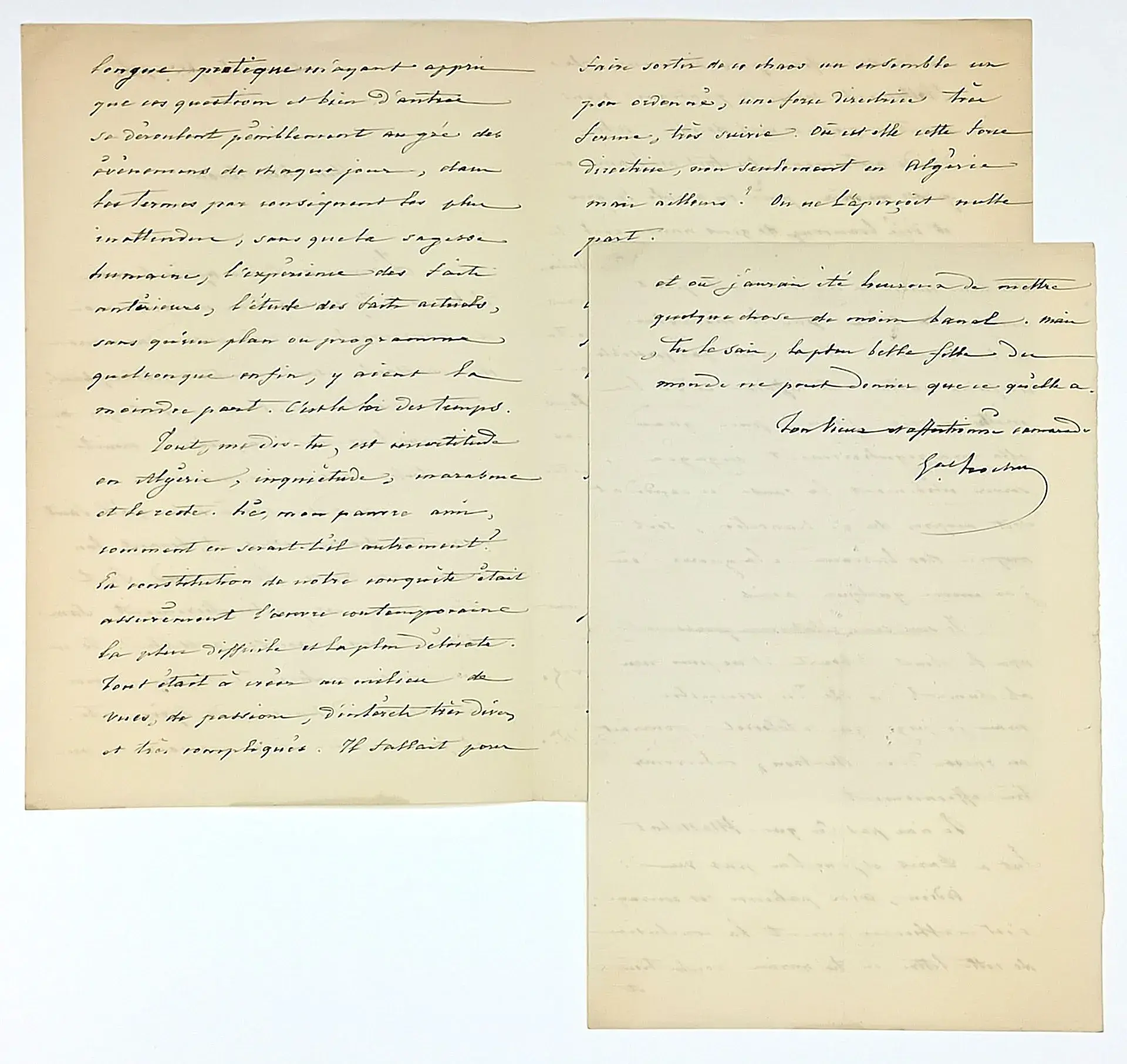
General TROCHU Louis-Jules, Governor of Paris on August 11, - Lot 586
10/20/2026

€200
Stima: €200
Porta la tua asta ai collezionisti di tutto il mondo!
Pubblica oraIscrivendoti, accetti la politica sulla privacy. Annulla l'iscrizione in qualsiasi momento.
Barnebys HQ
Brahegatan 10
BOX 5038
114 37 Stockholm
